|
II. GENERAL INFORMATION
A. Brief History
Prior to the
coming of the Spaniards in 1596, Samar Island was called in different names (Samal,
Ibabao/Cibabao, Tandaya, etc.). Legend says that when the Spaniards arrived in
Homonhon Island, they met a wounded man and asked the name of the place, he
replied "samad" which implies of what had happened to him for he didn't
understand Spanish. So, the word "samad" was adopted with an alteration in the
last letter (from d to r). The name Samar was derived from the local dialect "Samad",
meaning wound or cut, which aptly describes the rough physical features of the
island that is rugged and deeply dissected by streams or a multitude of rivers
dissect the island in various directions like crease-crossing wounds.
In the early
days of Spanish occupation, Samar and Leyte islands were under the jurisdiction
of Cebu. In 1735, Samar and Leyte were separated from Cebu and declared into one
province with Carigara, Leyte as the capital. Consequently, during the
Spanish-American colonial period, Samar was separated from Leyte and declared as
a province in 1768 with Catbalogan as the provincial capital.
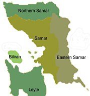
On June 19,
1965, RA 4221 was passed by Congress dividing Samar Island into three (3)
provinces: Northern Samar with Catarman as capital, Eastern Samar with Borongan
as capital, and Western Samar with Catbalogan as capital. A subsequent
legislation passed on June 21, 1969 (RA 5650) changed the title "Western Samar"
to simply Samar.
B. Geography
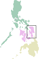
 Samar
Island lies southeast of Luzon. It occupies the northernmost section of Eastern
Visayas or Region VIII. The province of Samar (western) occupies the
southwestern part of Samar Island. It has the largest land area (559,100 has.)
among the three provinces which constitute 42% of the island's total land area
and 26% of Region VIII. The San Juanico Bridge connects Samar to the province of
Leyte on the southeast across the San Juanico Strait. It is bounded on the north
by Northern Samar, on the east by Eastern Samar, on the south by Leyte Gulf and
on the west by the Samar Sea. Catbalogan City, the provincial capital is 107
kilometers from Tacloban City, the regional capital of Eastern Visayas. Samar
Island lies southeast of Luzon. It occupies the northernmost section of Eastern
Visayas or Region VIII. The province of Samar (western) occupies the
southwestern part of Samar Island. It has the largest land area (559,100 has.)
among the three provinces which constitute 42% of the island's total land area
and 26% of Region VIII. The San Juanico Bridge connects Samar to the province of
Leyte on the southeast across the San Juanico Strait. It is bounded on the north
by Northern Samar, on the east by Eastern Samar, on the south by Leyte Gulf and
on the west by the Samar Sea. Catbalogan City, the provincial capital is 107
kilometers from Tacloban City, the regional capital of Eastern Visayas.
C. Political Subdivision
With the
approval of RA 4221 on June 19, 1965, Samar Island was divided into three (3)
provinces: Northern Samar, Eastern Samar and Western Samar (officially known as
Samar by RA 5650 on June 21, 1969). The province of Samar is divided into two
(2) congressional districts, with the first district composed of nine (9)
municipalities and one city (Calbayog), while the second district is composed of
15 municipalities and one city (Catbalogan), the capital and a newly
created city. Majority of the municipalities and the two (2) cities are
coastal and only four (4) are in the mainland. The province has a total of 951 barangays, being 409 coastal and 542 inland.
|
First District |
Second District |
| 1. Almagro |
1. Basey |
11.
San Jose de Buan |
| 2. Calbayog City |
2. Calbiga |
12.
San Sebastian |
| 3. Gandara |
3. Catbalogan City |
13.
Sta. Rita |
| 4. Matuguinao |
4. Daram |
14.
Talalora |
| 5. Pagsanghan |
5. Hinabangan |
15.
Villareal |
| 6.
San Jorge |
6. Jiabong |
16.
Zumarraga |
| 7.
Sta. Margarita |
7. Marabut |
|
| 8. Sto. Niño |
8. Motiong |
|
| 9. Tagapul-an |
9. Paranas |
|
| 10.
Tarangnan |
10. Pinabacdao |
|
Number of Barangays by City/Municipality
|
City/Municipality |
No. of Barangays |
City/Municipality |
No. of Barangays |
|
1. Almagro |
23 |
14. Paranas |
44 |
|
2. Basey |
51 |
15. Pinabacdao |
24 |
|
3. Calbayog City |
157 |
16. San Jorge |
41 |
|
4. Calbiga |
41 |
17. San Jose de Buan |
14 |
|
5. Catbalogan City |
57 |
18. San Sebastian |
14 |
|
6. Daram |
58 |
19. Sta. Margarita |
36 |
|
7. Gandara |
69 |
20. Sta. Rita |
38 |
|
8. Hinabangan |
21 |
21. Sto. Niño |
13 |
|
9. Jiabong |
34 |
22. Tagapul-an |
14 |
| 10.
Marabut |
24 |
23. Talalora |
11 |
| 11.
Matuguinao |
20 |
24. Tarangnan |
41 |
| 12.
Motiong |
30 |
25. Villareal |
38 |
| 13.
Pagsanghan |
13 |
26. Zumarraga |
25 |
|
Sub-Total: |
598 |
|
353 |
|
Total: |
951 |
With regards to income class, 10
municipalities are in the fifth class, eight (8) are in the fourth class and
only Basey stepped to first class (previously was a third class municipality) in
addition to the cities of Calbayog and Catbalogan. Basey is one of the nine
municipalities that increased revenue in 2010. Daram is the sole third class
municipality and two municipalities each in the second and sixth class
respectively.
Income Classification by
City/Municipality
|
Municipality |
Class |
Municipality |
Class |
|
1.
Almagro |
Fifth |
14.
Paranas |
Second |
|
2.
Basey |
First |
15.
Pinabacdao |
Fourth |
|
3.
Calbayog City |
First |
16.
San Jorge |
Fourth |
|
4.
Calbiga |
Fourth |
17.
San Jose de Buan |
Fourth |
|
5.
Catbalogan City |
First |
18.
San Sebastian |
Sixth |
|
6.
Daram |
Third |
19.
Sta. Margarita |
Fourth |
|
7.
Gandara |
Second |
20.
Sta. Rita |
Fifth |
|
8.
Hinabangan |
Fourth |
21.
Sto. Niño |
Fifth |
|
9.
Jiabong |
Fifth |
22.
Tagapul-an |
Fifth |
|
10.
Marabut |
Fifth |
23.
Talalora |
Sixth |
|
11.
Matuguinao |
Fifth |
24.
Tarangnan |
Fourth |
|
12.
Motiong |
Fourth |
25.
Villareal |
Fifth |
|
13.
Pagsanghan |
Fifth |
26.
Zumarraga |
Fifth |
D. Topography
Samar province
is hilly and mountainous ranging from 200 to 800 meters high. Slopes are
generally steep and bare of trees. Run-off rainwater on these slopes is
substantial and can provoke flooding in lowland areas. Topsoil is carried to the
sea, creating hydrosols and enlarging mudflats and mangrove areas. The erosion
of mountain areas enlarges the coastal plains of Samar. The coastline is
approximately 300 kilometers long, which boosts its rich fishing grounds and
contribute much to our economy.
E.
Languages/Dialect
The province
of Samar is a member of the Samar-Leyte (Waray Group), the sixth largest
cultural-linguistic group in the country. The majority (90.2%) of the total
household population speaks the Waray dialect. The remaining 9.8 percent speaks
Cebuano (8.1%), Boholano (0.07%), Tagalog (0.5%) and other dialects. Other
languages used are English and Chinese.
F.
Religious Sects
Majority of
the Samareños is devout Roman Catholics, comprising about 95 percent of the
total households population. Other religious sects are United Church of Christ, Aglipay, Iglesia ni Cristo, Mormons, Baptist, Born Again Christians and the 7th
Day Adventists.
G.
Citizenship
Almost 95
percent of the total households population of the province of Samar are Filipino
citizens. The rest are Chinese, Americans and other foreign nationals.
next►►
Climate and Rainfall
|